PARTNERSHIP
HUNGARY - Municipality of Alsótold
Our history
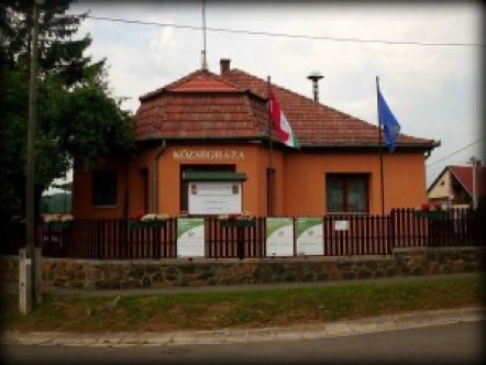
Alsótold is located in the northern part of the country, in Nógrád County. The small settlement is located in the heart of Cserhát, which is part of the Northern Central Mountains, in a small valley, in the Toldi basin. Like the neighboring Cserhátszentiváni and Garábi basins, the basin was created after the fragmentation of the Cserhát andesite blankets at the end of the Pliocene (5.3-2.5 million years ago). The natural and geographical environment of the village is determined by the specific characteristics of the mountains. It is surrounded by pastures, land suitable for agricultural cultivation, and forests rich in wildlife. The latter are mostly made up of cherry-oak forests, interspersed with smaller patches of pine, juniper and acacia.
The village is crossed by the Szuha stream, which originates north of Garáb, on the south side of the Zsúnyi mountain. For this reason, it is calledZsúnyi streamuntil Cserhátszentiván. Most maps show it that way.
It is also worth mentioning the National Blue Tour line, whose tour number 19, the Becske-Mátraverebély section, also passes through Alsótold, as well as the Kelet-Cserhát Landscape Protection District, whose border runs along the edge of the village.
newEUROPEwaysN2S
Co-funded by the European Union. The views and opinions expressed are those of the author(s) and do not necessarily reflect the views of the European Union or the European Education and Culture Executive Agency (EACEA). Neither the European Union nor the EACEA can be held responsible for those views.
PARTNERSHIP
PORTUGAL - União de Freguesias de Melres e Medas
ITALY - Associazione Moving Europe
SPAIN - Asociación Sociocultural Luenda
POLAND - Gmina Kamionka Wielka
LITHUANIA - Kelmes Rajono Savivaldybes Admnistracija
PORTUGAL - Câmara Municipal da Ribeira Grande
HUNGARY - Municipality of Alsótold municipality
SLOVAKIA - Obec Velka Calomija
CYPRUS - Athienou Municipality
CZECH REPUBLIC - Oblastni Spolek Českého červeného kříže Ústí nad Orlicí
CONTACTS:
União de Freguesias de Melres e Medas
Rua Padre Jerónimo, 100
4515-552 Melres